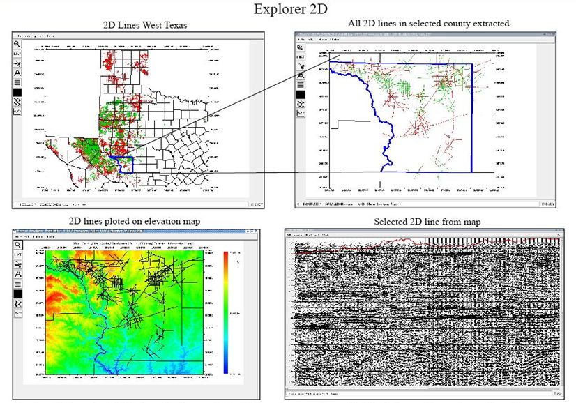
- •Explorer 2D is used to QC 2d lines
- •2D lines can be loaded into the system from a SP1 file, Seisup station matrix or a Segy file with geometry in the headers.
- •A elevation map and culture can be loaded with the lines loaded on top of the elevations
- •Select a line from the map or a list then select a file to display the seismic data.
- •A very large number of lines can be QC in a very short time.
2D & 3D SeismicFull Service Processing |
Gravity & Magnetic
Lineament Mapping |

