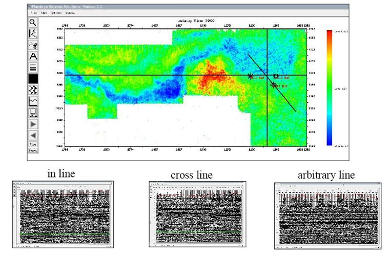
- Explorer 3D is used to quickly examine a 3D seismic survey.
- You can load time slices, fold, fold by offset, station elevations and trace headers generated by the Seisup processing system.
- Different types of data can be overlaid on the data such as wells, culture, faults and text files.
- In lines, cross lines and arbitrary lines can be draw on to the map then a GCIh or a Segy file can be selected for a seismic display output.
- The data can be displayed in in line, cross line or XYs.